Former / Today
How has the national park area developed over the past decades? Our impressive before-and-after comparisons answer this question. Move the arrows in the middle of the pictures to the right to escape completely into the past. If you drag the arrow to the left, you will see more of the present, bit by bit.
The first glance only hints at the dynamics of these mountains
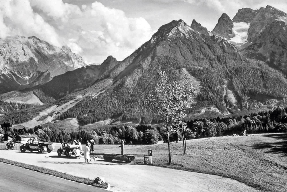

Original recording [1938]
80 years ago, only a few motorists came here to the parking lot at Taubensee. They were able to catch their first glimpse of what was then known as the "Königssee nature reserve". The blue ice glacier on the Hochkalter (top right) still filled the entire mountain basin.
Comparison recording [2018]
Today, there are often a lot of motorists parked along the German Alpine Road. They can only guess at the changes in the forest cover and the dynamics of the mountain world. More clearly visible is the change in size of the Blue Ice Glacier - a consequence of climate change.
From the Jenner works the drama, the dynamics must be explained
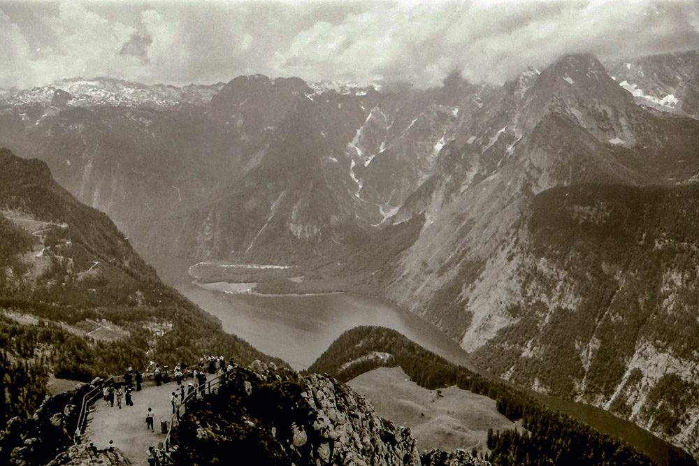
Original recording [1977]
Already about 40 years ago, the magnificence of this mountain landscape impressed all visitors. The variety of forests, alpine pastures, steep mountains and the Königssee could be recognized by everyone. However, visitors could not recognize the dynamics after the forest fire on the steep eastern flank of the Watzmann.
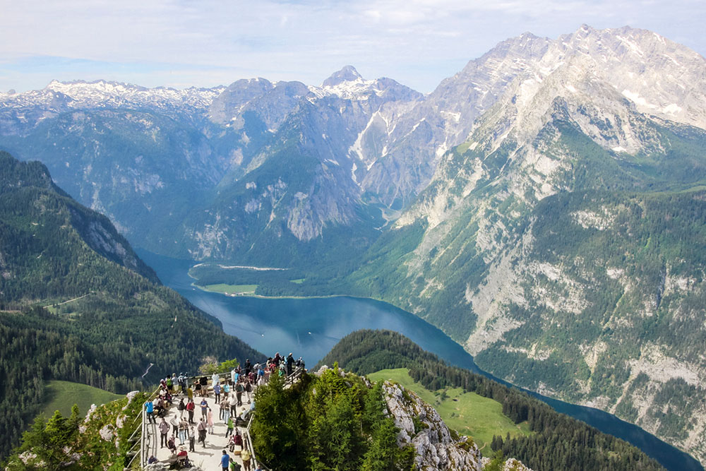
Comparison recording [2017]
Even today, visitors admire this magnificent and diverse landscape, and the number of tourists is constantly increasing. The special dynamics of such a mountain range and the adaptation of nature to disturbances such as landslides, floods and other extreme events must be explained using examples, as is done in the information points of the national park.
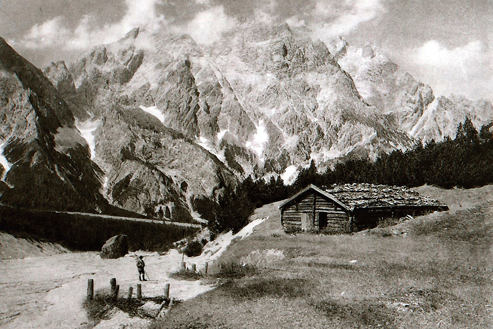
Different intensive use and care of the alpine pastures
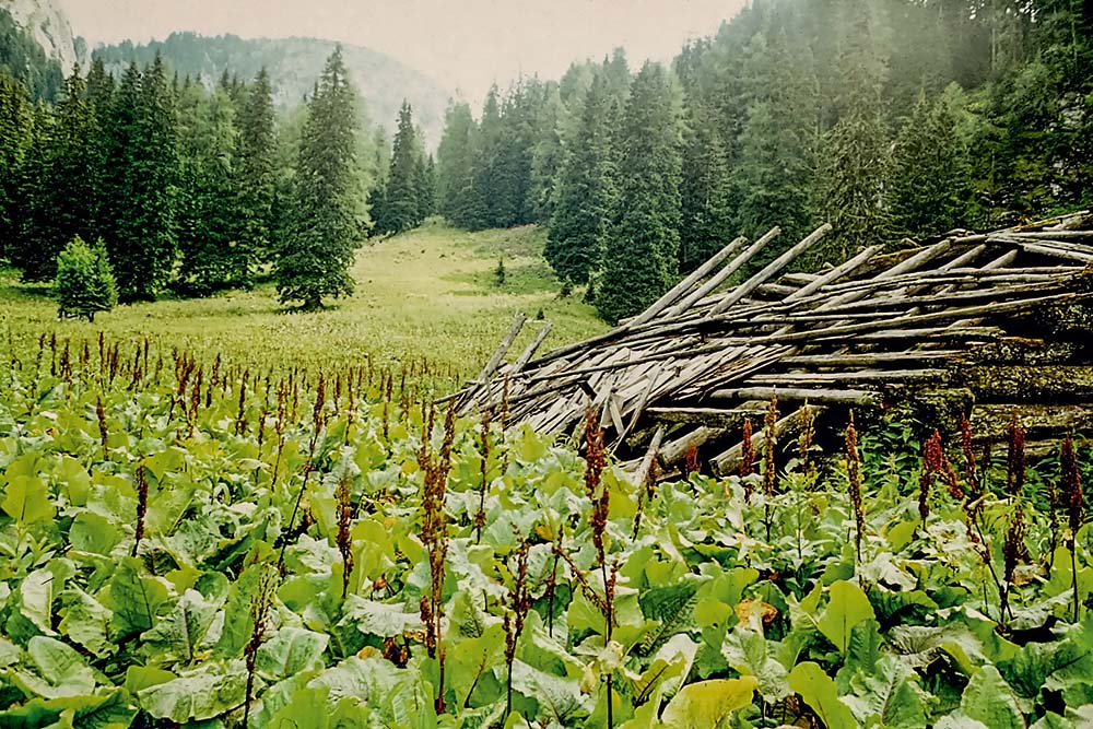
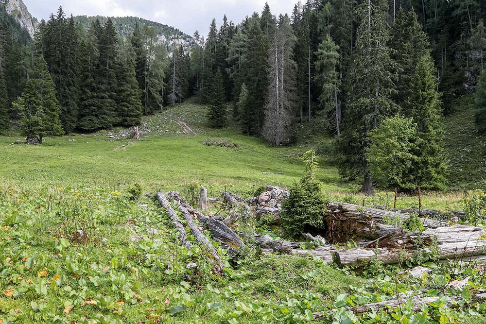
Original recording [1975]
To feed the population, forests were cleared 900 years ago to create alpine pastures. These alpine pastures used to be maintained in a labor-intensive way. For more than a hundred years, many alpine pastures have been abandoned or used only extensively. The alpine pasture barracks, as here on the Seeau alp, fell into disrepair and alpine pasture care was discontinued.
Comparison recording [2018]
More than 40 years later, the alpine pasture is still grazed for short periods. The decline of the alpine steamer is clearly visible. The wood of the alpine steamer has largely been "recycled" into humus. And it is precisely in these places that young trees have been able to gain a foothold. They form a nucleus for reforestation.
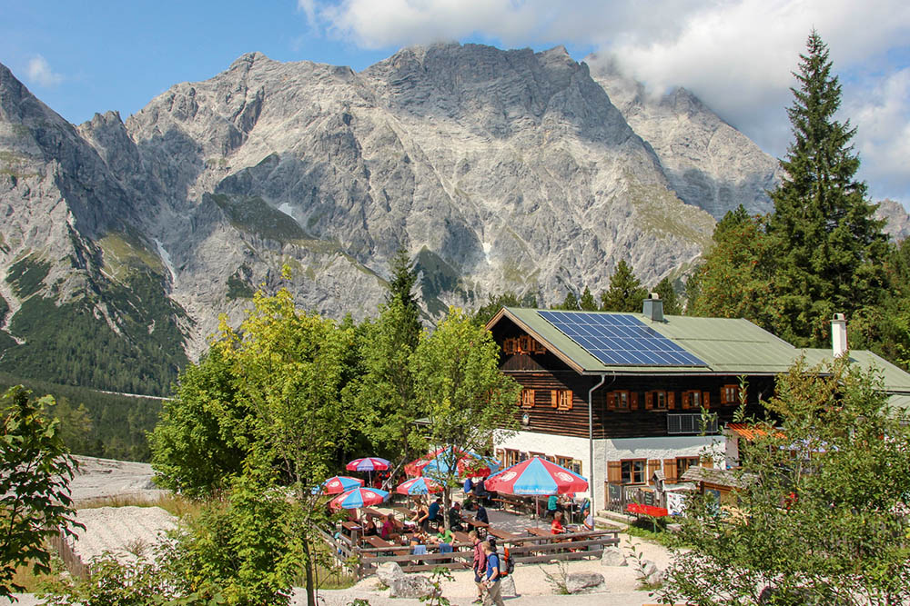
Tourism becomes the most important source of income
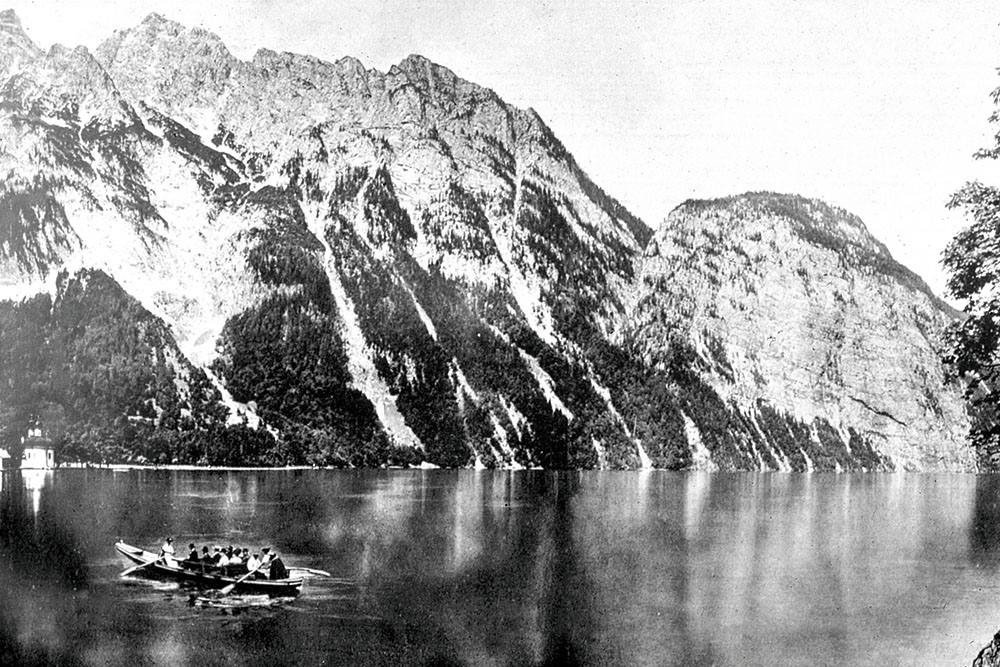
Original recording [1912]
The descriptions of early explorers and the paintings of Romantic painters led already 190 years ago to tourism, which became a new source of income. The breakthrough for tourism came in 1888 with the construction of the railroad to Berchtesgaden. The journey across the Königssee used to be extremely labor-intensive.
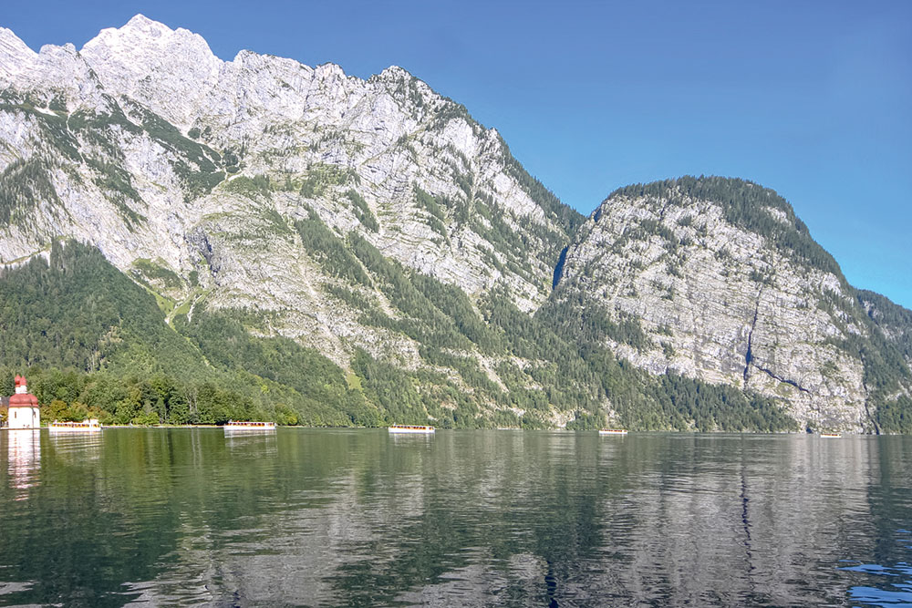
Comparison recording [2018]
Today, tourism is one of the most important sources of income for the local population. Navigation across Lake Königssee has been greatly streamlined; since 1909, guest boats have been using environmentally friendly electric propulsion. Provided that visitors stay on the designated and well-developed hiking trails, they pose no threat to nature.
A simple Almkaser becomes a much frequented mountain inn
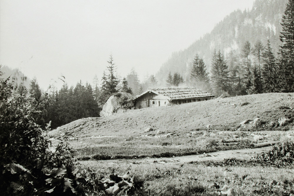
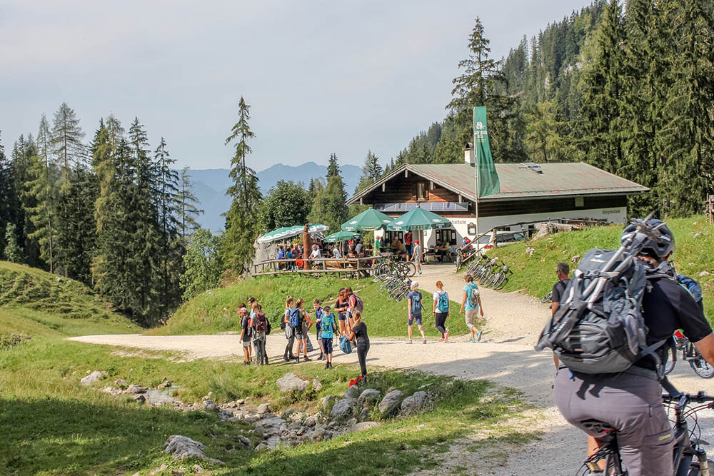
Original recording [1928]
90 years ago, a simple Almkaser stood on a comparatively productive alpine pasture on the Königsbachalm. Next to it there were several other alpine pasture barracks. During the summer months, a dairymaid and a shepherd's boy lived in each of the barracks. They cared for and herded the cattle. The care of the alpine pasture was very labor-intensive.
Comparison recording [2018]
In the meantime, the Almkaser has been expanded into a modern mountain inn. Many mountain hikers and mountain bikers come here. As long as they stay on the main trails, the visitors do not pose a major disturbance to nature.
A simple Almkaser became the accommodation house
Original recording [1912]
At the southern end of the Wimbachgries there was once a small grassy area. In the past, alpine farming was also practiced in this extreme location. This had to be abandoned about 110 years ago, the Almkaser fell into disrepair. Afterwards, a simple accommodation hut was built.
Comparison recording [2018]
The accommodation hut is now well developed and is visited by many hikers. The aim of the national park is to inform the visitors in all lodging houses factually about the development of the habitats and also about their endangerment.