The picture shows the logo and the words National Park Berchtesgaden next to the small Bavarian coat of arms
  • Home
  • Nature
      • National Park
      • » Goals
      • » Zonation
      • » History
      • » Management
      • » Regulations
      • Facts
      • » Past and present
      • » Habitats
      • » Geology
      • » Flora
      • » Fauna
      • » Climate
      • Awards
      • » IUCN
      • » Europadiplom
      • » EMAS
      • » UN-Dekade
      • » Environmental education
      • » Accessibility
  • Adventure
      • Rules & Notes
      • » Safety in the high mountains
      • » Accessibility of the paths
      • » Mountain huts & pastures
      • » Behaviour rules
      • » Climbing concept
      • » Paraglider
      • Tips for on the go
      • » Barrier free
      • » Hike
      • » Bike
      • » Winter tours
      • » Outside to the toilet
      • Events
      • » Hiking program
  • Education
      • For groups
      • » General information
      • » Nursery school and elementary schools
      • » Secondary schools
      • » Adults
      • » Guided tours through the exhibition
      • Partner schools
      • » About the project
      • » Events & school projects
      • » Participating schools
      • » Newsletter
      • » Alpine School
      • » Material
  • Research
      • Projects
      • » Ongoing
      • » Finished
      • Data
      • » Working group
      • » Basic data
      • Monitoring
      • » Golden eagle
      • » Bearded vulture
      • » Climate
      • » Spring
      • » Biodiversity
      • » Forest Intensive Plot
      • Cooperations
      • » TU München
      • » Climate
      • » Ecosystems
      • » Application
  • Infopoints
      • Haus der Berge
      • » Information center
      • » Temporary exhibitions
      • » Education Centre
      • » Outdoor area
      • » Gastronomy
      • National Park
      • » Hintersee
      • » Wimbachbrücke
      • » Jenner mountain station
      • » St. Bartholomä
      • » Kühroint
      • » Engert-Holzstube
      • Other facilities
      • » Carrion ecology
      • » Observation Point
      • » Deer Feeding
      • » Suspension bridge
      • » Mobile stands
      • » Info2go
      • » Actionbound
  • Service
      • About us
      • » Contact
      • » Organization chart
      • » Contact Person
      • » Offices
      • » Cooperations
      • Getting there
      • » On foot
      • » By bus & train
      • » By car
      • Partner
      • » Partner initiative
      • » National Park Partner
      • » Biosphere Region
      • » More service links
      • Publications
      • » Programs
      • » Research reports
      • » Peer reviewed
      • Press
      • » Filming permits
      • » Press releases
      • » Press Photos
      • Media library
      • » Webcams
      • » Photos
      • » Videos
      • » App
      • General
      • » Imprint
      • » Accessibility
      • » Sign language
      • » Visual aid
      • » Font size
      • » Color contrast
      • » Contact
      • » Sitemap
      • » Netiquette
      • » FAQ
  • Startseite >> 
  • English >> 
  • Research >> 
  • Data >> 
  • Basic Data

Basic data Bavarian National Park

In close cooperation with the Bavarian Forest National Park, we develop a harmonized collection of consistent basic datasets, which are of fundamental thematic relevance for joint ecosystem research activities in both parks.

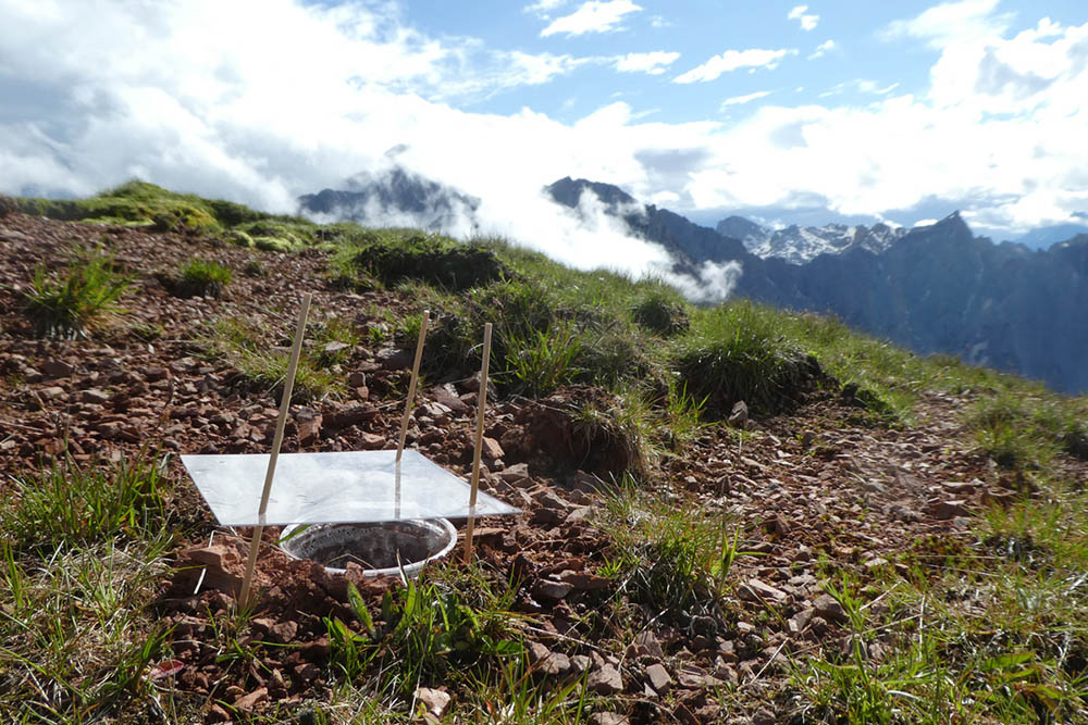
Research site with malaise trap

Referring to the current trends of increasing digitization, FAIR data principles (Findable, Accessible, Interoperable, Re-usable) and growing national and international initiatives on research data infrastructure, Berchtesgaden National Park has launched a project explicitly dealing with research data management.

The aim is to compile - together with the Bavarian Forest National Park - a collection of basic datasets that are suitable for cross-regional research in both parks. Over the past decades, the two protected areas have been creating abundant data by numerous research projects. However, these data are often not directly accessible by science and the comparability of regional data sources is not always obvious.
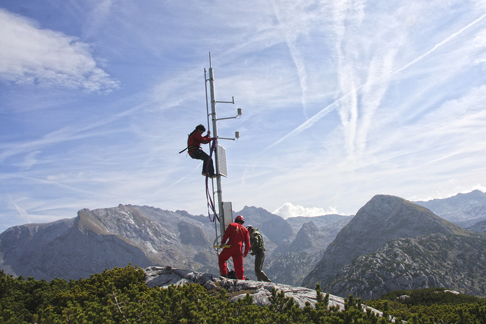
Climate station
Climate station

For this reason, the challenge of the project is to find and harmonize relevant data in both areas covering a wide range of topics. Main project steps foreseen are the conversion of the collected data into appropriate formats, the addition of metadata and the provision to researchers at a commonly accessible storage location.

The result expected will be a set of basic data that covers thematically the parameters of major relevance to ecosystem research (e.g. climate and soil data) and spatially the Berchtesgaden site at the northern rim of the Alps as well as the Bavarian Forest site in direct vicinity to the Czech Bohemian Forest.

Ground trap
Ground trap

Data:

  • Data Management
  • Basic data

Research

Projects

  • Ongoing


    • AlpsLife
    • Abandoned alpine pastures
    • Alpine pastures and climate change
    • Elevation gradients
    • Ecotones and succession
    • LiveAlpsNature
    • Forest dynamics
    • Wildlife
  • Finished


    • Karst hydrology
    • Spring monitoring
    • UTM

Monitoring

  • Golden eagle
  • Bearded vulture
  • Climate
  • springs
  • Biodiversity
  • Forest Inventory Intensive Plot

Data

  • Working group data management
  • Basic data

Cooperations

  • TU Munich
  • Climate
  • Ecosystems
  • Application

Information Center

  • Logo Haus der Berge

  • +49 8652 979060-0
  • hausderberge@npv-bgd.bayern.de
  • Hanielstraße 7
    83471 Berchtesgaden

National Park Administration


  • +49 8652 9686-0
  • poststelle@npv-bgd.bayern.de
  • Doktorberg 6
    83471 Berchtesgaden

Service

  • FAQ

Awards

  • Logo IUCN II Logo Europadiplom Logo EMAS Logo UN-Dekade Logo Environmental Education Bavaria Logo Barrier-free Bavaria


Social Media

Visit us at Social Media


Deutsche Version

  • Deutschlands einziger Alpen-Nationalpark

Berchtesgaden National Park - Privacy | Imprint | Sitemap | Contact